Archaeologists call it ME019-050, but they don't yet know what it is
There are many archaeological monuments and features in the Brú na Bóinne complex. Some of these are very obvious in the landscape – there are passage-tombs, mounds, enclosures, standing stones and cursus monuments. However, others that are less obvious provide archaeologists with many questions.
The curious archaeological feature in the foreground of this drone image is known to archaeologists only as ME019-050. This is its record number in the Record of Monuments and Places (RMP). In the RMP, it is classified simply as an "earthwork" and is described thus:
Slightly raised circular area defined by slight scarp (diam. c. 30m) (O'Kelly 1978, 50, site A1).
I've been flying the drone over the Bend of the Boyne recently and have been enthralled with how much extra detail is visible in certain monuments and archaeological features when the sun is extremely low in the winter sky. This is a case in point. I've flown over ME019-050 before and taken photos of it and it looked simply like a circular mound with a flat top.
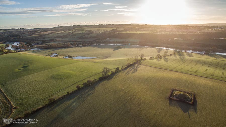
But what is it? My latest drone images appear to show what looks like a "mound within a mound". In fact, it looks like there's a very small mound or circular shape within a larger, flat-topped mound. It's intriguing. It's unlike anything else in the Bend of the Boyne complex.
Obviously with the proximity of this monument to Newgrange and so many other passage-tombs, one is tempted to speculate that's what it might be. However, if it is a passage-tomb, it's very unusual. Could it be that the smaller raised area is the remains of a cairn over a chamber? And the rest of the mound/cairn has been denuded over time?
It looks similar in some respects to Rathcroghan mound, which is also a raised, flat-topped mound. Could we be looking at something that was built in the Iron Age? Or even something Neolithic that was later altered in the Iron Age?
ME019-050 is just one of many features in the landscape that keep the interests of archaeologists nicely piqued. In the past decade, remote sensing techniques have revealed up to 200 possible monuments and archaeological features. ME019-050, although its presence has been long known about, presents a mystery to archaeologists that is yet to be solved. What is it and when was it built?
We cannot answer that question right now. But it would be interesting to find out.
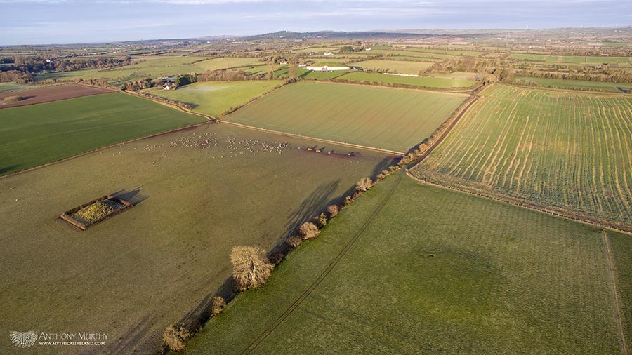
In the main image at the top of the page, you can also see Mound A in the field behind ME019-050. Mound A has been protected from damage by a hedge around it. But also surrounding it is the remains of a large circular enclosure, or henge, just one of several in the Bend of the Boyne complex.