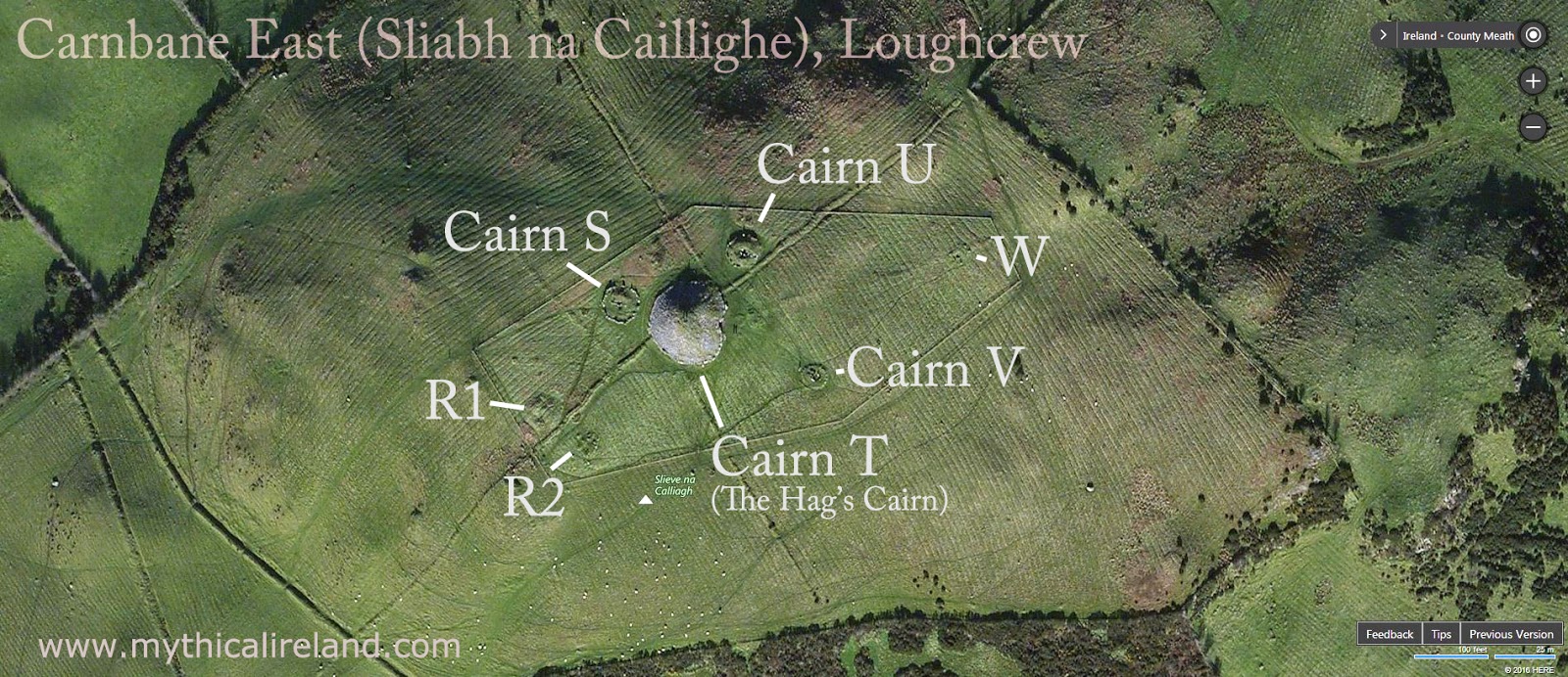
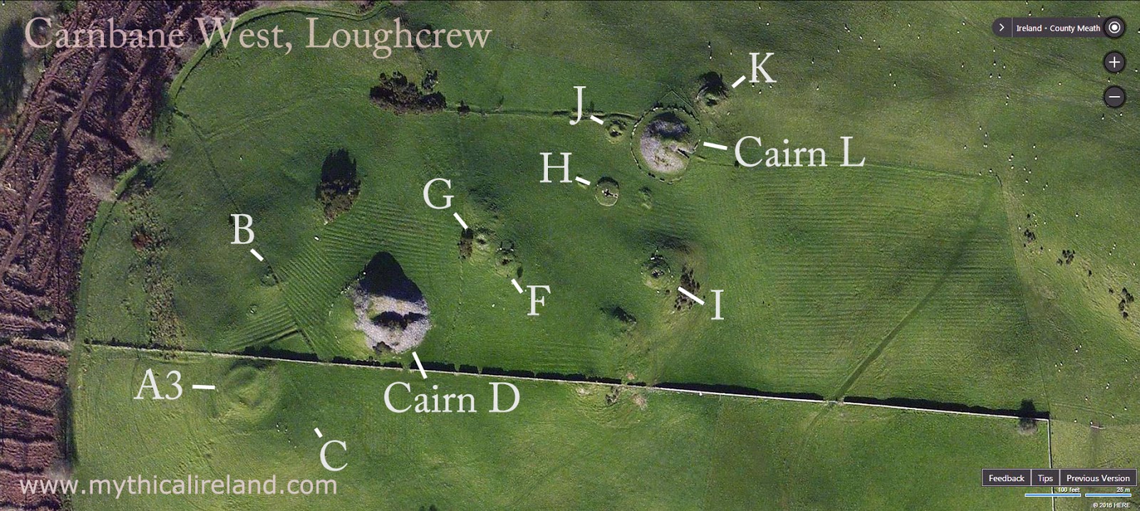
Maps of the cairns at Sliabh na Caillighe, Loughcrew
I've created maps of the cairns at Sliabh na Caillighe/Loughcrew, using Bing Maps. The cairns are believed to be older than Newgrange, dating possibly to 3500BC, and were given letter designations by Eugene Conwell, who excavated some of them in the 1860s. The hill known as Carnbane West today was, according to local folklore, known previously simply as Carnbane (from carn bán, the "white cairn"). The hill labelled Carnbane East today was known in the past as Sliabh na Caillighe, the Mountain of the Hag.
The best known of the cairns are Cairn T, called the Hag's Cairn, which is aligned towards sunrise on the equinoxes, and Cairn L on Carnbane, which is aligned towards sunrise at Samhain (November) and Imbolc (February).
For more on the Samhain alignment of Cairn L, see this page. For more on the equinox alignment of Cairn T, see this page.
Don't forget to watch the video below, in which I give a quick overview of the hills of Loughcrew using Google Earth. This will give you a sense of where the various cairns are located and which are considered the principal peaks. It will also give you a good idea of the location of the cairns in relation to the Brú na Bóinne complex (Newgrange, Knowth and Dowth):
For up to date news on dramatic discoveries, magnificent monuments, and terrific tours join our newsletter. You can unsubscribe any time and we promise emails are not too frequent and they always contain something of interest and an occasional special offer.
Stay connected to Mythical Ireland
For up to date news on dramatic discoveries, magnificent monuments, and terrific tours join our newsletter. You can unsubscribe any time and we promise emails are not too frequent and they always contain something of interest and an occasional special offer.
Choosing a selection results in a full page refresh.