The complex ringfort of Summerbank, Loughcrew
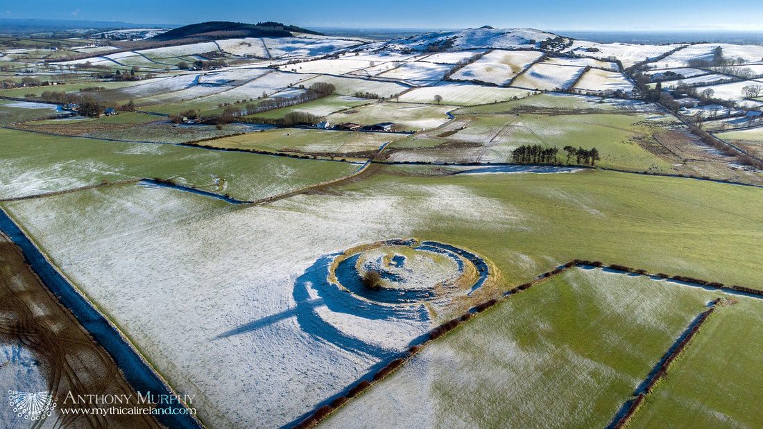
The Drumsawry (from Irish Druim Samhradh, the Summer Ridge or Summerbank) ringfort close to the Loughcrew Hills in Co. Meath is one of the most interesting I've seen, and has an unusual and complex structure. The ringfort itself is a well-preserved bivallate rath of about 80 metres in diameter. However, that ringfort is situated off-centre (to the northeast edge) of a much larger circular enclosure of about 120 metres in diameter. A combination of low sun and frosty grass in these drone images helps to accentuate some of the features of this remarkable multifaceted structure.

Picture 1: Drumsawry ringfort and enclosure with Loughcrew Hills behind.
In the first picture, you should be able to clearly see the well-preserved double banks of the rath. (Buy your own print of that photo here). The ditch of the larger enclosure seems better preserved in the east, and a bit more denuded on the western side (closer to the drone). Behind, in the distance, are the tree-covered hills of Patrickstown (left) and Slieve na Calliagh (right) with Cairn T on its summit.

Picture 2: Possible sinuous causeway leading away from ringfort and enclosure to NW.
The second photo shows what appears to be a sinuous causeway of some sort running northwestwards away from the monument (towards the drone camera). Traces of this causeway can be seen in the interior of the large outer enclosure, and it appears to lead up to or connect with an apparent possible entrance in the outer bank of the ringfort on its NW segment. There is a definite entrance in this bank on the southeastern side of the ringfort.

Picture 3: Possible enclosure ditch or hollow way southeast of Drumsawry ringfort.
Picture 3 shows what appears to be some sort of semicircular ditch situated to the immediate southeast of the Drumsawry ringfort. This feature is not listed in the National Monuments Service Historic Environment Viewer. Could it be some sort of hollow way or ancient road? Or is it part of a large oval or subcircular enclosure?
I have lots of questions! An obvious question is this - was the Drumsawry ringfort (remember ringforts date almost exclusively to the second half of the first millennium AD) built inside a larger, more ancient enclosure? Was this enclosure, perhaps, a Late Neolithic henge? (This does seem unlikely, since the aerial images appear to show the large enclosure's ditch OUTSIDE the bank).
What is the nature or age of the large enclosure? At 120m in diameter it is the right size for a henge. Might it perhaps be a large Iron Age enclosure?
What is the nature of the apparent sinuous causeway leading towards the large enclosure from the northwest? Is it perhaps just an old field boundary? Is the large arc likewise just an old field boundary, or is it part of another monument?
I am aware that a LiDAR survey of this area was carried out by an Anglo-Irish team of experts a number of years ago. I suspect they may be able to answer some of the questions above. I look forward to chatting with them.