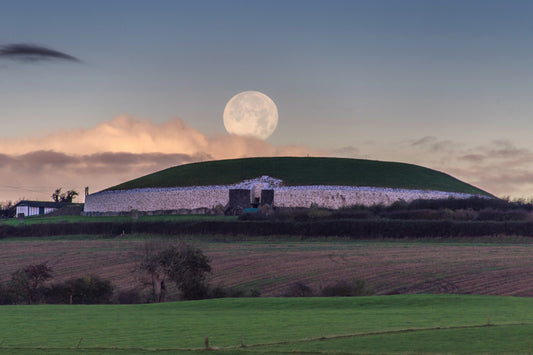
Ancient Alignment: Stone Age cairn in Meath points to ancestral tomb 94 kilometres away in Sligo
A lone cairn on Kesh Corran mountain in County Sligo, the westernmost of the Carrowkeel/Kesh Corran complex of Neolithic passage-tombs, is visible from Cairn S at Slieve na Calliagh in the Loughcrew complex, Co. Meath. Anthony Murphy investigates.
I have been visiting the Loughcrew complex of megalithic monuments on the highest hills of County Meath for the past 22 years. I am always struck by the incredible views of Ireland offered from Slieve na Calliagh, one of four hills at Loughcrew and the one that receives most visitors.
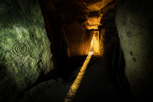
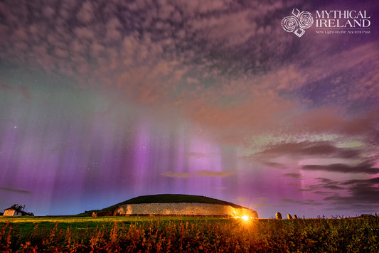
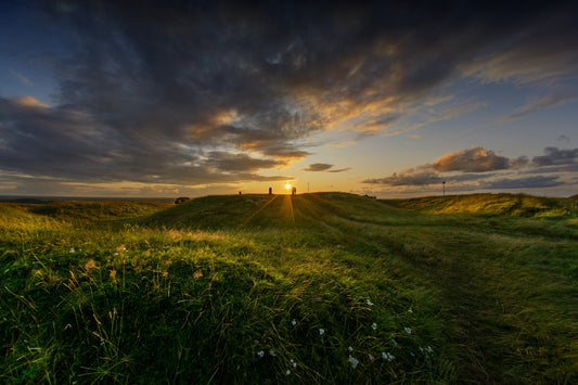
For years, I had wondered about something. I had long known that Cairn S, a cairn immediately to the northeast of Cairn T (the largest cairn on Slieve na Calliagh), had a passage facing towards the northwestern aspect. Its alignment towards sunsets at the time of Bealtaine and Lughnasa had been documented in the 1980s by Martin Brennan and his team.

However, it is clear that the relatively short passage of Cairn S would possibly admit a range of sunset azimuths, and this is borne out by visual observations which show that the sun is visible from the Y-shaped chamber of Cairn S from before the astronomical date of Lughnasa (usually around 7th August) until at least the last day of August.
Previous visits by this author at the time of astronomical Lughnasa had demonstrated that the sun was setting north (right) of what might be considered the centreline view through the passageway. One beautiful aspect of the sunsets at Bealtaine and Lughnasa as viewed from the chamber of Cairn S is the fact that shortly before setting, the sun is reflected in the waters of Lough Sheelin, which lies some 16km (10 miles) approximately to the northwest of Loughcrew.

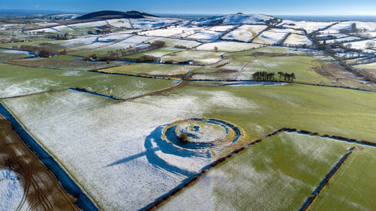
The centreline of Cairn S actually points fairly accurately to the Carrowkeel complex of megalithic passage-tombs in County Sligo, some 90km or so distant from Slieve na Calliagh. But that’s just a coincidence, right? I could never be sure. It is certainly not unusual for a passage-tomb to be oriented towards other passage-tombs or tomb complexes, even if the sites at either end of the apparent alignment are not intervisible. Take, for instance, the fact that six cairns at Loughcrew are oriented such that they point in the direction of Newgrange (within 10.5°), with the latter not being visible from any of those cairns. Jean McMann wrote in 1994 that six cairns at the Loughcrew complex face towards the Fourknocks complex in eastern Meath (within 8°) – the latter being visible from Loughcrew.

The fact that Cairn S points towards the Carrowkeel/Kesh Corran complex (they are considered one large and related group by archaeologists) in Sligo can be easily demonstrated using Google Earth. “It’s not rocket science,” as they say. Whether any of the cairns in the Carrowkeel complex were actually visible from Loughcrew did not seem so easy to determine.
Even 20 years ago, I would train my telephoto lens on those distant misty mountains in the northwest that are visible from Slieve na Calliagh and take photos, but I’ll be honest and admit that I never knew what mountains they were, nor what county they were in.
Thankfully, there are websites and smartphone apps that can show what distant peaks are visible from a particular eminence these days. (For example, peakvisor.com and heywhatsthat.com). These sites seemed to indicate a very slim possibility of intervisibility between Slieve na Calliagh and Carrowkeel/Kesh Corran.

But when it comes to these matters I’m like a dog with a bone. Knowing that the best time to see really distant (and therefore faint and hazy) hills and mountains was when the sun was low in the sky in that direction, I decided to set out for Cairn S at Slieve na Calliagh armed with my 25x100 binoculars, which are a substantial observational tool. I had the company of friend and blacksmith Tom King for the evening, and we had the great fortune of a beautiful sunset and a clear landscape.
After a 10-minute walk from the carpark to the summit, I quickly set up the giant binoculars on a tripod at Cairn S and began to scan the distant horizon above and beyond Lough Sheelin. On a clear day, Cuilcagh Mountain, which straddles the border between counties Cavan and Fermanagh (and thus the border between the Republic of Ireland and Northern Ireland) can be easily seen some 68km (42.5 miles approx.) to the northwest. Sweeping away to the left from Cuilcagh are a range of similarly misty mountains/hills, which I think include the peaks of Benbrack in Co. Cavan, Bencroy in Co. Leitrim, Slieve Anierin in Co. Leitrim and the more distant Corry Mountain (also in Leitrim but close to the borders with counties Sligo and Roscommon. This latter, and a hill to its west, have a smattering of wind turbines on them which were visible through the binoculars and in images taken from Cairn S.
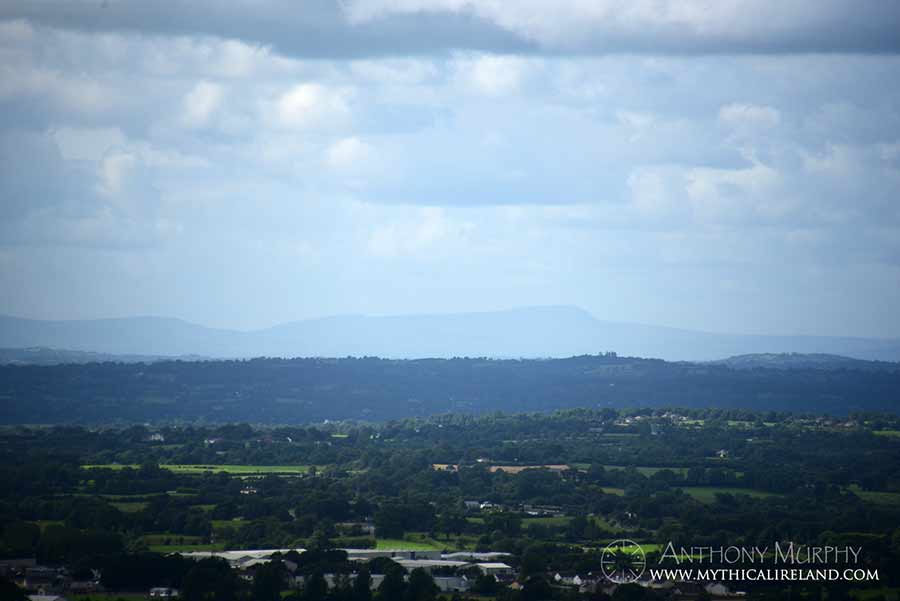
Corry Mountain lies at some 80km (50 miles) approx. from Cairn S at Loughcrew. But I thought I recognised the wind turbines because I had seen them the previous Saturday while flying my drone at the Carrowkeel complex.
Using the binoculars, I scanned slowly towards the west of these distant misty hills with the wind turbines on them, but these hills dipped down behind closer, intervening hills. I didn’t hold out much hope of seeing any of the Carrowkeel complex.

But a moment later, I caught sight of something. Above some trees on a quite distant hill, a very slender portion of the top of a faint and very distant ridge was visible, like a skim of butter on a slice of bread. Wow. What was this? I looked for a moment and then noticed the clincher – a “blip” of sorts towards the right (north) of this faint and distant ridge.

That “blip” is in fact the lone cairn on the summit of the mountain of Kesh Corran, the westernmost and indeed the tallest of the mountains in the Carrowkeel/Kesh Corran complex of monuments. It lies at a distance of 94km (58.5 miles) from Cairn S. Incredibly, one cairn of the Carrowkeel/Kesh Corran complex is indeed visible from Slieve na Calliagh. But barely so. And it certainly is not “visible” in any practical meaning of the word without the aid of either a telephoto lens or binoculars.
And that got me and Tom talking. Did the builders of Loughcrew know that Kesh Corran cairn was visible when they built Cairn S? Did they specifically orient it back towards their old homeland, the place of their ancestors? The Sligo monuments are older than their Meath counterparts. Were they pointing Cairn S back at Carrowkeel/Kesh Corran where their progenitors had been buried decades and centuries before?
How would you determine, in the Neolithic, if two places at the very limit of visibility and very far away from each other, could be seen one from the other?
To be continued…
(With gratitude to Tom King for his company and photographs).
Addendum 1 (added 2nd September 2022):
An interesting addendum to the previous post about Cairn S at Loughcrew pointing to Kesh Corran cairn in Sligo. An examation of the orientation of the cairns of Loughcrew, published in Jean McMann\'s 1994 paper \'Forms of power: dimensions of an Irish megalithic landscape\' (Antiquity 68, pp. 525-44) reveals that only TWO of the cairns in the entire complex have orientations towards the west. All the rest are oriented towards the eastern horizon, with the exception of one (Cairn W) which points towards the south.

The two pointing to the western aspect are Cairn V, oriented NW (which Ken Williams recently observed is aligned on summer solstice sunset) and Cairn S, pointing WNW. So while V has a solstice function, and S has a probable Bealtaine/Lughnasa sunset alignment, only Cairn S points to Carrowkeel/Kesh Corran. It had a very specific and unusual orientation.