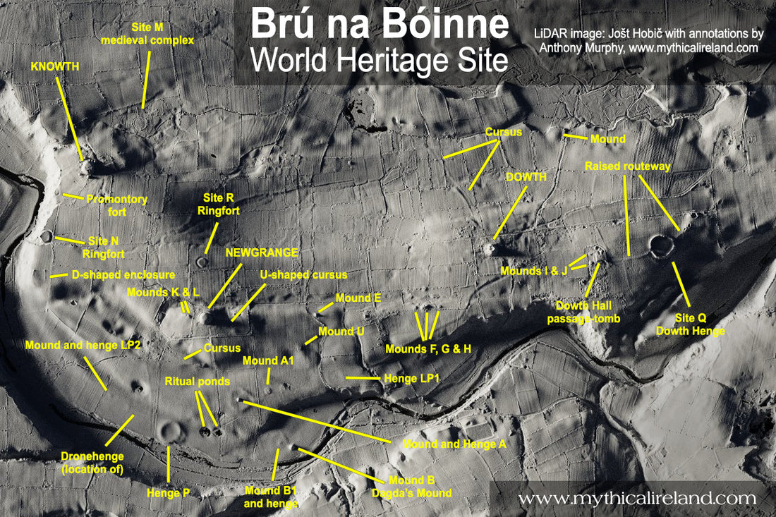
The many monuments of Brú na Bóinne
I have created this annotated top-down LiDAR image of the Bend of the Boyne (based on an image shared by Jošt Hobič on his Twitter feed) to demonstrate just how many monuments there are in the World Heritage Site at Brú na Bóinne. This image shows the mega-mounds of Newgrange, Knowth and Dowth, plus a plethora of other monuments - including smaller megalithic tombs/mounds, cursus monuments, henges, ringforts and unclassified mounds.
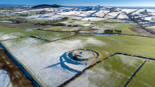
Remember that this pictures shows just SOME of the monuments and archaeological remnants at Brú na Bóinne, representing several thousand years of human activity here. There are lots of features, for instance, that do not show up on LiDAR. Dronehenge, which measures 154m in diameter (over 500ft) is NOT visible in LiDAR imagery, but shows up occasionally as crop marks during drought conditions.

Annotated top-down LiDAR image of Brú na Bóinne monuments.
There are several post circles (four-posters, probably dating to the Late Neolithic) which are also not visible in this image, along with some likely Bronze Age barrows (showing as ring-ditches in some remote sensing imagery) and early medieval monuments. Not shown either is the so-called Great Palisade - the subsurface remnants (post holes) of a giant 900m-long "fence" across the middle terrace of Newgrange Farm.
It's difficult to keep an accurate tally of the monuments at Brú na Bóinne. There is no single resource either online or in print which lists everything - i.e. all the monuments known from previous surveys, and all those found with remote sensing, including aerial photography, ground-penetrating radar, LiDAR and geophys.

This is the unlabelled LiDAR image of Brú na Bóinne. Courtesy Jošt Hobič.
The Historic Environment Viewer of the National Monuments Service, which is an invaluable tool for searching for recorded monuments, is not yet up to date with recent finds at Brú na Bóinne.
Perhaps Brú na Bóinne, being a Unesco World Heritage Site, needs its own online map, to be updated on a regular basis with new discoveries and data?
In the meantime, enjoy this image. It's interesting how a lot of the monuments are clustered in an area closer to the river. The large passage-tombs (Newgrange, Knowth, Dowth) are all situated on the highest ridges/summits of the area. But it's interesting how the lower-lying land northeast of Newgrange and northwest of Dowth seems to be quite devoid of archaeological features.

Here's a previous oblique LiDAR image I annotated.
Perhaps we just haven't found them yet!

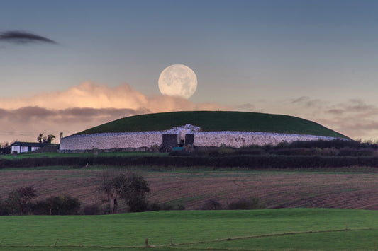
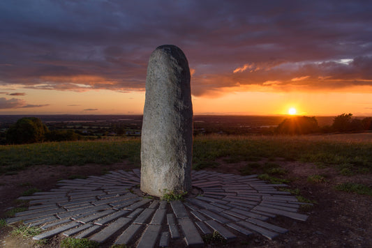
An aerial image of the Brú na Bóinne World Heritage Site taken from a plane in summer.

1 comment
Could someone put together an “overlay” image that color codes both seen and unseen sites in one Big Picture?